4
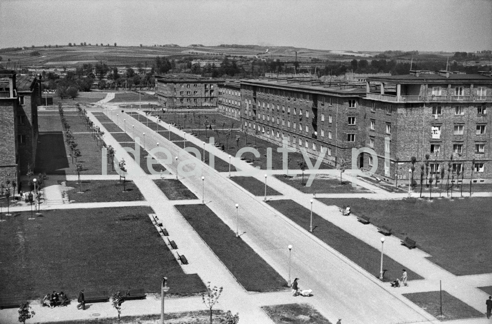
Northward view from the B-33 and C-33 estates (Słoneczne and Urocze), so-called inner-city axis (Aleja Róż). Further back on the right: residential buildings on the B-2 Południe estate (Zielone). Mid-1950s.
Widok od strony osiedli B-33 i C-33 (Słoneczne i Urocze) w kierunku północnym, tzw. oś śródmiejska (aleja Róż). W głębi, po prawej stronie widoczne domy mieszkalne na osiedlu B-2 Południe (Zielone), połowa lat 50. XX w.
Photo by Henryk Makarewicz/idealcity.pl
Miejsce
Nowa Huta
Czas
1 June 1955
Tagi
Aleja Róż,
Górali Estate,
Nowa Huta,
street,
street lights,
Urocze Estate,
Wzgórza Krzesławickie,
Zielone Estate,
promenade,
lawn
GPS
50.078833, 20.039183