2255
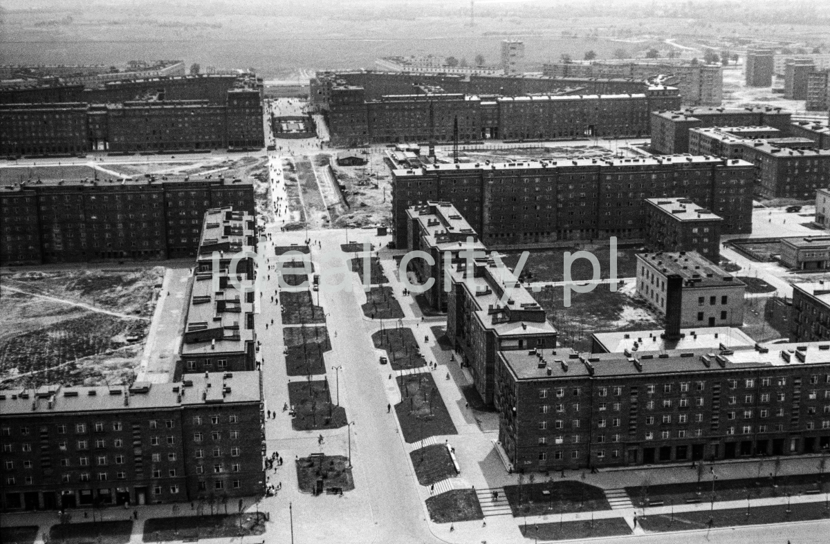
The inner-city axis – Aleja Róż running towards Plac Centralny. In the foreground: buildings at the intersection of Aleja Róż and Żeromskiego Street: Słoneczne (B-33) Estate on the left and Urocze (C-33) Estate on the right. 1960s.
Centralna oś alei Róż biegnąca w stronę placu Centralnego. Na pierwszym planie widoczna zabudowa przy skrzyżowaniu alei Roż i Żeromskiego: osiedle Słonecze (B-33 ) po lewej i osiedle Urocze (C-33) po prawej.
Lata 60. XX w.
Photo by Henryk Makarewicz/idealcity.pl
Miejsce
Nowa Huta
Czas
5 October 1959
Tagi
aerial photography,
Aleja Róż,
Centrum B,
Centrum C,
Słoneczne Estate,
Urocze Estate
GPS
50.079242, 20.039642