2431
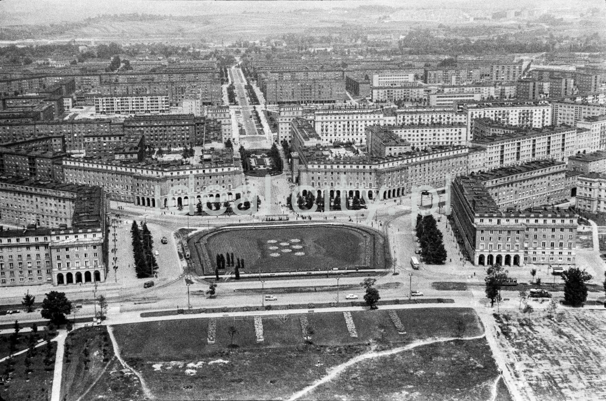
An aerial photograph showing the view from Nowa Huta Meadows towards Plac Centalny, making the symmetry of the urban layout of Nowa Huta evident. 1960s.
Zdjęcie lotnicze od strony Łąk Nowohuckich, w kierunku Placu Centralnego pokazujące symetrie planu urbanistycznego Nowej Huty. Lata 60. XX w.
Photo by Henryk Makarewicz/idealcity.pl
Miejsce
Nowa Huta
Czas
5 July 1965
Tagi
aerial photography,
Centrum A,
Centrum B,
Centrum C,
Centrum D,
Plac Centralny
GPS
50.070986, 20.036863